
Geomarketing
Nowadays, a lot of data has a spatial reference. As a result, it is easily possible to analyse the information regionalised and to visualise it spatially in the form of map representations. SALETELLIGENCE utilises map representations for the most diverse questions and utilises specific geographical information systems for this.
Examples of relevant issues are:
- Structuring of sales territories
- Development of specific maps for the representation of analysis of KPI and pharmaceutical data
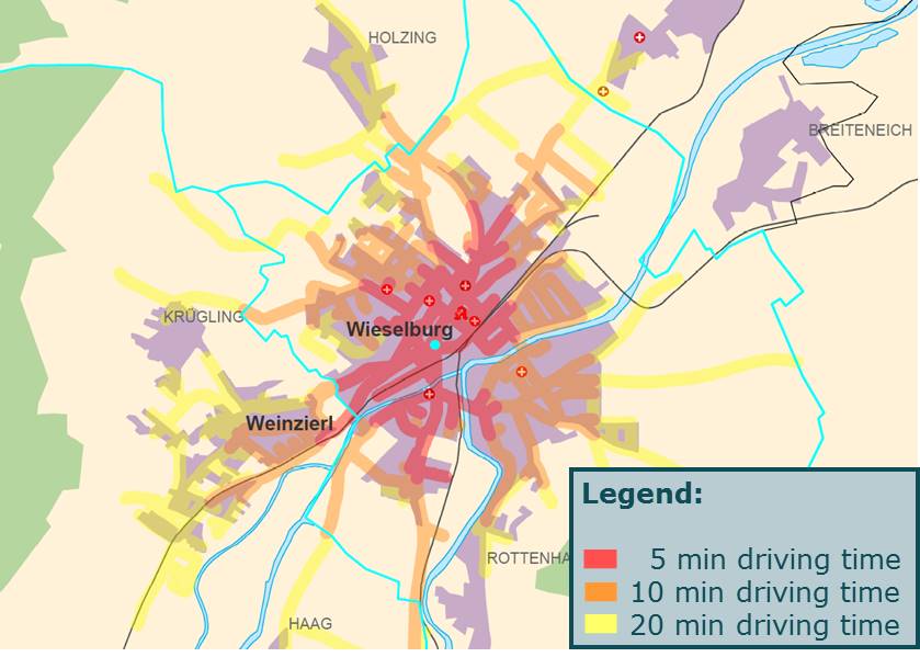
- Vicinity analyses and selections based on distances and driving times at street level Representation of networks and KOL relationships
- Representation of networks and KOL relationships
- Storing of additional information in map representations (geo PDF)
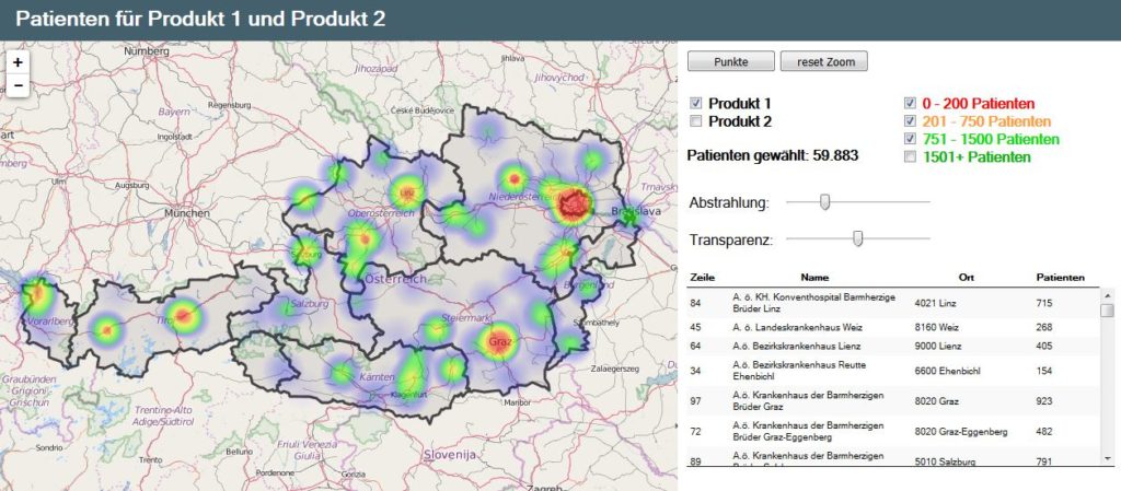
Example of a web-based analysis tool